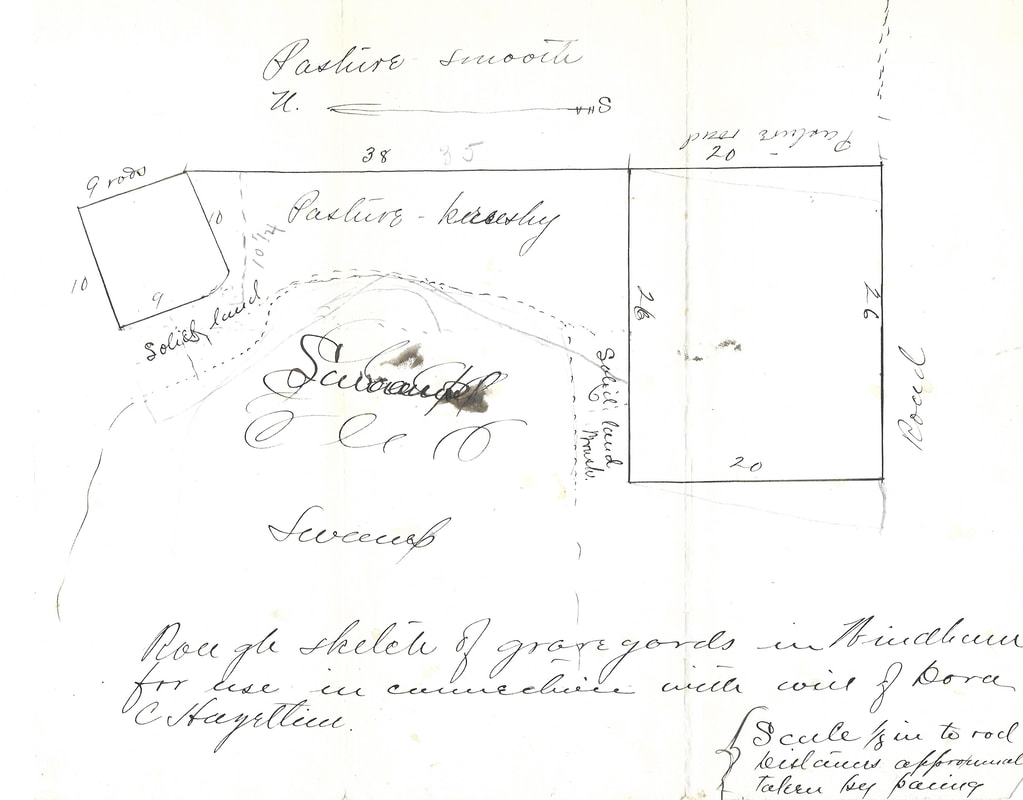
1860s hand drawn plan of the Cemetery on the Plains
The plan shown above was drawn in the mid-1860s upon the death of Dora C. Hazeltine. The person who drew up the plan did not sign his name, but he did leave behind an interesting not that the distances were calculated by pacing them out, and that it was drawn in a 1/8" to one rod scale. At the time this view was drawn up the newer section in the middle of the two graveyards had not yet been used as a cemetery and was indicated as "pasture". The plan shows what is now Cobbetts Pond Road on the right, and the swamp in the back. What is now Ministerial Road, is referred to only as "pasture road", with a large open pasture on the opposite side.